Neches River Monitoring
Introduction
The Neches River is more than 400 miles long, extending from near Canton, Texas, southeastward to Sabine Lake. Totaling more than 10,000 square miles, the Neches River watershed and its tributaries flow through many miles of picturesque forests including Big Thicket National Preserve. These heavily wooded areas are one of the sources of naturally occurring organic materials, which, at times, gives the Neches River its distinctive “tea” color. Two large reservoirs, Sam Rayburn and B. A. Steinhagen (Dam “B”), collect and store water as it enters the basin. These reservoirs provide a reliable source of fresh water to the many communities, farms, and industries served by the Lower Neches Valley Authority (LNVA). In 2003, a saltwater barrier was constructed just south of the Neches confluence with Pine Island Bayou to maintain these freshwater resources. The Neches River also sustains the region’s deepwater ship channel, the Sabine-Neches Waterway, maintained locally by Sabine-Neches Navigation District.
For almost 70 years, the Academy of Natural Sciences has conducted periodic monitoring studies of the lower Neches River. During October 2021, the Academy completed the seventh in a series of biological and water quality surveys
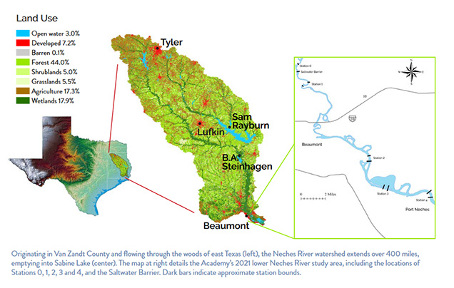
This study was coordinated by LNVA with support from members of the Southeast Texas Plant Managers Forum. Components of the current and historical surveys have included environmental chemistry (water and sediments), protozoans, plankton, attached algae, aquatic macrophytes (rooted or floating aquatic plants), macroinvertebrates, and fish. Multiple levels of the ecosystem are studied because no single group is reliably the best indicator of ecosystem health, and there is a broad consensus that maintaining the integrity of the entire ecosystem is important. Neches River surveys in 1953, 1970, 1996, and 2003 investigated four portions of the river: Stations 1, 2, 3, and 4. In 2021, Station 0 was added upstream of the saltwater barrier to document the freshwater fauna with the barrier fully operational. In total, five portions (Stations 0, 1, 2, 3, and 4) of the lower Neches River from Beaumont to Port Neches, Texas, were surveyed.
Chemistry
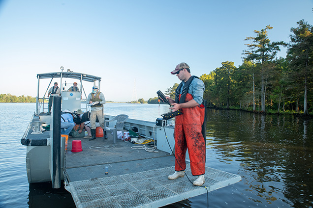
The goals of this component were to assess potential differences among stations, compare with applicable water quality guidelines and standards, and compare results to those of previous studies by the Academy of Natural Sciences.
In 2021, samples from the lower tidal Neches River met published water quality guidelines from the State of Texas (TCEQ 2000). Stations below the saltwater barrier exhibited salinity stratification with depth, indicating limited mixing of the water column. Concentrations of dissolved oxygen (DO), which is essential for aquatic life, were lowest near the bottom of Stations 2 and 3. Low DO concentrations near the river bed are commonly found in estuarine zones. Microbial activity, in conjunction with limited mixing throughout the water column, can deplete the available DO near the bottom. Nitrogen, phosphorus, and fecal coliform values are commonly used as indicators of human and agricultural activities. Nutrient parameters were variable across stations, with dissolved nitrate concentrations increasing substantially from the upstream stations to Stations 2 through 4. The distribution of compounds indicates no particular source of pollution to the river, suggesting that inputs from upstream and non-point sources (e.g., urban runoff) are the predominant sources. Contaminants such as volatile organic compounds and trace metals were not elevated.
Overall, the lower tidal Neches River exhibited slightly better water quality than found in the 2003 survey. Long-term trend analyses showed dissolved oxygen saturation values have increased over a 40-year period.
Algae

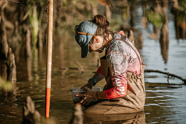
Positioned at the base of the food web, algae are important primary producers that provide habitat and a nutrient rich food source for other aquatic organisms. Through the process of photosynthesis, algae produce an important byproduct, oxygen, essential for all aquatic life. Many algal forms, especially diatoms (algae with silica shells), like those at top right, are useful living indicators of environmental conditions, as they respond quickly to changes and are sensitive to different water quality parameters.
Samples of attached algae and diatoms were collected by hand from many different habitats such as mud and sand shorelines, aquatic plants and hard substrates like submerged tree roots. Algae have been used to evaluate water quality in the lower Neches River for the past 70 years. Looking at changes in the algae communities, such as the number of algal species at each site (species richness) and whether the population is balanced or there is dominance by one or a few species, can provide information about the health of the system.
In 2021, changes in the algal communities were largely driven by the salinity gradient that decreased while moving upstream. As in previous surveys, Stations 2 and 3 presented low species richness, high dominance of a single diatom species, and a high presence of blue-green algae, likely reflecting the higher amounts of industry at these locations. Overall, the 2021 algal survey revealed similar results to 2003 and showed improvement from past surveys.
Macroinvertebrates
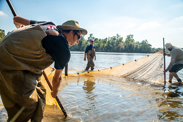
Macroinvertebrates (shrimp, clams, snails, aquatic insects, etc.) generally provide the link in the aquatic food chain between algae and animals occupying higher feeding levels, like fish. Their limited mobility, relatively long life spans of some species, and responses to a wide range of environmental conditions make them effective in monitoring long-term change. The growth and reproduction of many types are a direct reflection of changes in water quality. Some macroinvertebrates, like shrimp and blue crabs, are also vital to people who live and work along the Texas Gulf Coast. During the 2021 survey, many juvenile shrimp and blue crabs were captured at all stations, indicating the Neches River provides vital nursery habitat for these incredibly important commercial species.
For the 2021 survey, multiple sampling methods were employed at all potential habitats (e.g., mud, sand, aquatic plants, woody debris) to characterize the community at each station. Macroinvertebrates were collected by hand or with a dip net to gather detritus (decaying organic material) and then macroinvertebrates were picked from the material.
Macroinvertebrates can be divided into insect and noninsect groups. Insects dominate freshwater environments and become less diverse when salinity increases, and non-insects are common in both fresh and saline waters. Among noninsect macroinvertebrates, crustaceans (e.g., shrimp, crayfish), mollusks (e.g., clams, snails), and leeches are the dominant freshwater groups, while polychaete worms (e.g., clam worms) and a very diverse crustacean assemblage (e.g., crabs, barnacles) are more common in saline waters.
Salinity is influenced by annual river discharge and precipitation patterns. Based on salinity concentrations during the 2021 survey, Stations 0 and 1 were considered freshwater, while Stations 2 through 4 were considered brackish (more saline). In 2021, more insect species were found at upstream Station 0 and 1 as compared to downstream Stations 2 through 4. Non-insect macroinvertebrates showed less variation among stations, but were more abundant than insects at Stations 2 through 4.
Comparing community composition among surveys generally shows an increase in number of insect species over time. There were slightly fewer insect species in 2021 than in 2003; this could be attributed to a storm event in May or overarching changes in salinity from 2003. Non-insect macroinvertebrate species richness continued to improve in 2021 compared to previous Academy survey years.
Macroinvertebrate communities show water quality in the Neches River is similar to conditions observed in 2003, and indicate a long-term trend of improved water quality when compared to earlier surveys.
Fish
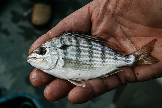
Fish occupy a wide range of trophic levels, including herbivores (e.g., menhaden which feed on phytoplankton), invertebrate feeders (including many bottom fishes), and top predators. Many species are recreationally and commercially important, particularly in southeast Texas, where fishing provides family recreation and is an integral part of the local economy.
The Academy fisheries studies document the numbers and kinds of fish that are found in the study area, including species found in shallow shoreline areas and deeper channel habitats. The numbers and diversity of fish are key indicators of the amount and quality of food available, accessible habitats, and water quality.
Fish were sampled using an otter trawl and a variety of seine and dip nets. Across all samples, 18,292 individuals and 66 species were collected using all techniques. The occurrence and abundance of most species was driven by a salinity gradient that extended from the lowermost Station 4 to the uppermost Station 0 with estuarine species (e.g. Bay Anchovy, Sand Seatrout, and Atlantic Croaker) associated with lower stations (2, 3, 4) and freshwater species (Freshwater Drum and Blue Catfish) associated with upper stations (0 and 1).
The five most abundant species collected by seining shoreline habitats were Bay Anchovy, Blacktail Shiner, Bullhead Minnow, Weed Shiner, and Ribbon Shiner. The five most abundant species collected by trawling bottom habitats were Bay Anchovy, Blue Catfish, Channel Catfish, Hogchoker, and Shoal Chub. Seining in 2021 indicated that there were less Bay Anchovy at Stations 2 and 3, however, trawling data did not show a similar pattern. Although patterns in Bay Anchovy should be assessed in future studies, the 2021 survey indicated all stations were in relatively good condition.
Over the past 70 years, water quality in the lower Neches River has greatly improved. The 1953 survey found that Station 2 did not support fish and identified oil slicks, high temperature and low dissolved oxygen as likely causes. Also at that time, similar conditions were observed at Stations 3 and 4 but to a lesser extent. The 2021 survey indicated that all stations were in relatively good condition, including vast improvements at Stations 2, 3, and 4 since the survey began in 1953.
The 2021 lower Neches River fish collections reflect a mixture of freshwater and estuarine species found throughout the inland and coastal waters of the northwestern region of the Gulf of Mexico. The varied wetlands and marsh habitats within the lower Neches River basin provide essential nursery areas for numerous fish species. The fish fauna recorded during the most recent survey indicates the existing water quality and habitat diversity support a productive and substantial fish community.
Summary
Biological surveys conducted by the Academy of Natural Sciences over the past 70 years have measured and evaluated the many forms of estuarine life in the lower Neches River, and the data show a trend of improved water quality and ecosystem integrity. These environmental monitoring studies provide a valuable reference that government, business, and the community can use when planning future development within the basin.
Today, the lower Neches estuary supports diverse algal, macroinvertebrate, and fish populations that are indicative of a healthier aquatic environment. The results of the Academy’s historical studies demonstrate how long-term regional planning and collaborative partnerships play an important role in improving water quality. In the future, the health of the lower Neches River will depend upon the conservation and enhancement of biological diversity throughout the estuary.
A reliable supply of fresh water is an important key to the well being of all forms of life found within the lower Neches River basin. The continued wise management of the watershed will ensure the availability of this valuable resource for future generations.
To learn more about Environmental Monitoring of the Lower Neches River, download the technical report or the non-technical report.
Lower Neches Valley Authority
P.O. Box 5117
Beaumont, TX 77708-5117
(409) 892-4011
www.lnva.dst.tx.us/